
Black Duck Cove
SHOReline TRAIL AND PICNIC BEACH
AMENITIES
- Black Duck Cove Beach
- Historic Freighter, The Eagle
- Hiking Trails and Biking Routes
- Shore Access/Paddle Trail
- Screened Picnic Pavilion
- Restroom

Parkland Information
Shorefront Access: 12,000 ft of Shorefront, 1000 ft Beach.
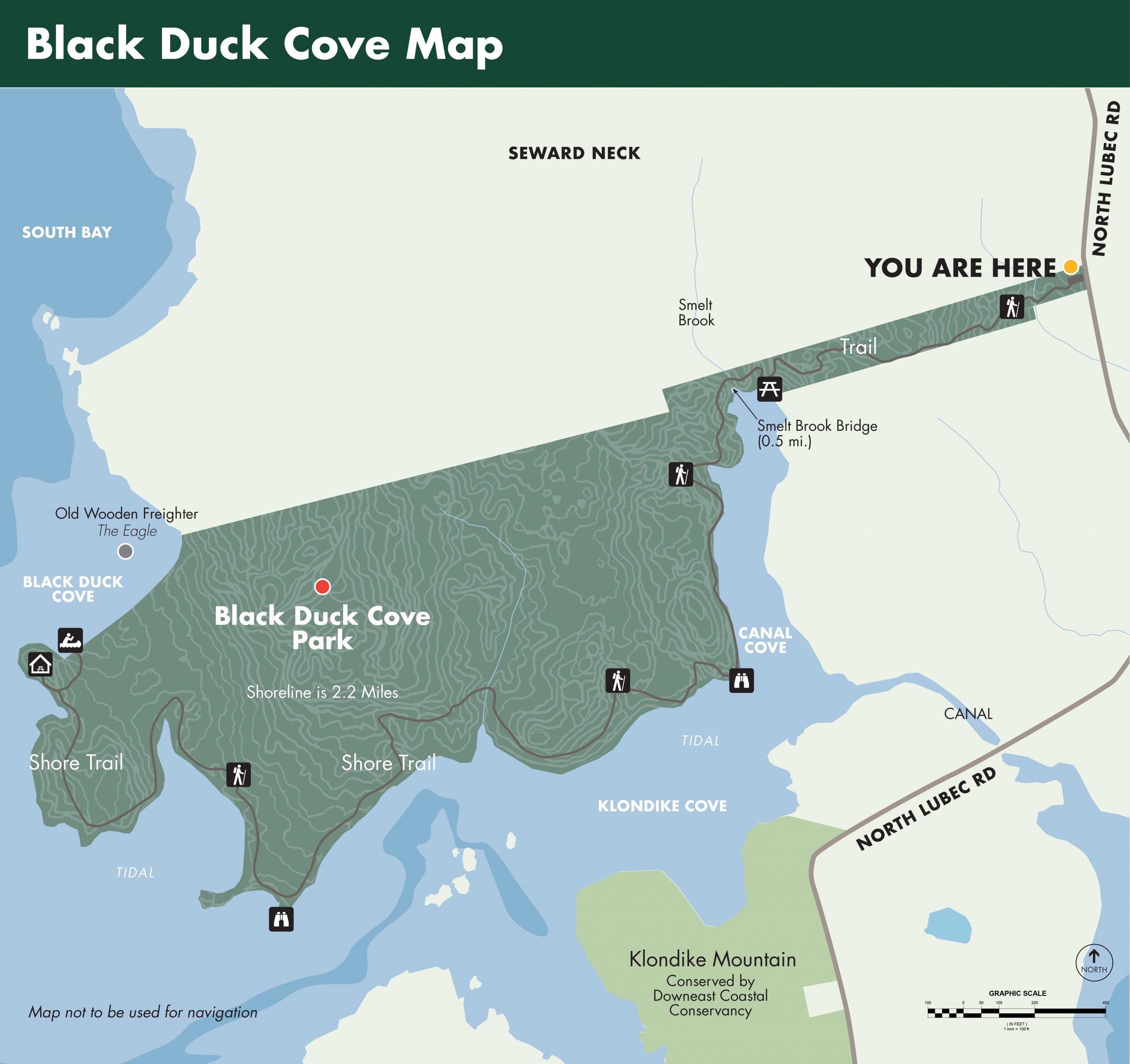
Hiking Trails: The Black Duck Shore Trail (2.5 miles – each way) twists through a cedar forest to the Smelt Brook bridge (0.5 miles). From Smelt Brook the trail follows the shoreline along Canal Cove and Klondike Cove. The trail ends at the High Bluff Picnic Pavilion and the Black Duck Cove beach. At low tide look for the wood skeleton of the sardine freighter ‘The Eagle’ scuttled in Black Duck Cove. From the High Bluff Picnic Pavilion enjoy a panorama of the wooded shoreline of South Bay, including The Nature Conservancy’s Long Island, Guvspuny Island and Scrub Island. Watch for seals on the exposed rock ledges 1500 ft to the South.
Paddle Trails: On calm days the long beach in Black Duck Cove can be reached from the Huckins Beach and Trail put-in. Travel south along Denbow Neck and cross South Bay on the east side of Long Island. Paddle at your own risk and stay aware of changing conditions.
Bike Routes: Bike south from Black Duck Cove to Downeast Coastal Conservancy’s Klondike Mountain (1.0 miles) and Old Farm Point (1.75 miles) or bike north to Pike Lands Cove and Downeast Coastal Conservancy’s Pike Lands West, both 3.25 miles from the Black Duck Cove parking lot. North Lubec Road offers incredible open views of Johnson Bay. Please bike with caution, North Lubec Road is narrow with some sharp curves.
Picnicking: The High Bluff Picnic Pavilion 2.5 miles from the parking lot at the end of the Black Duck Shore Trail is well worth the hike, on nice days picnic on the Black Duck Cove Beach and enjoy views north in South Bay.