Whiting Bay Beach
Picnic and Paddle
AMENITIES
- Gravel Beach
- Walking, Hiking and Biking Trails
- Shore Access
- Hand Boat Launch
- Picnic Tables and Screened Picnic Pavilion
- Restroom

Parkland Information
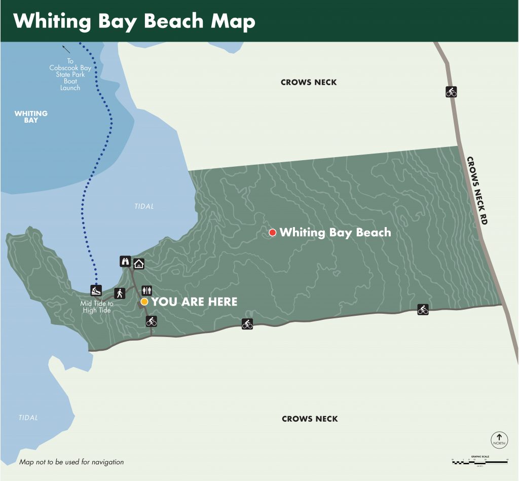
Shorefront Access: 3,000 ft of Shorefront. 400 ft Gravel Beach. Mid-high tide Hand Boat Launch
Walking and Biking Trails: South Waterway Drive (2,000 ft) leads from Crow’s Neck Road to the Whiting Bay Beach parking lot and clamming access. It was recently resurfaced for biking.
Hiking Trails: The Peninsula Loop (0.3 mi) offers spectacular 270° panorama of Whiting Bay and views of Bar Island, the Birch Beach Spur (1,000 ft) provides access to the long gravel beaches on the north side of the park.
Walk the gravel beach, which is accessed by a short 180 ft trail leaving from the north side of the parking lot.
Paddle Trails: Whiting Bay Beach offers kayak access to Whiting Bay. Launch at Whiting Bay Beach and cross the bay to Cobscook Bay State Park. At high tide, follow the shoreline of Crow’s Neck south to Crow’s Neck’s Carrying Place Cove, explore the interior of this wild cove from the water.
Paddle at your own risk and stay aware of changing conditions.
Bike Routes: From Whiting Bay Beach ride north to the end of the quiet and scenic Crow’s Neck Road to Race Point: Meadow and Reversing Falls Trail (2.4 miles), or south to the IFW’s Lily Lake (2.3 miles), to Red Point Shorefront Park (6.2 miles) or to parklands on Denbow Neck, South Bay Narrows (4.3 miles), Morong Cove (6.1 miles), Island Coves –visits welcome by appointment– (7.0 miles) or Huckins Beach and Trail (7.6 miles).
Picnicking: The Whiting Bay Picnic Pavilion overlooks Whiting Bay towards the north. See lobster boats on their moorings across the Bay in Edmunds while in the solitude of Trescott Township.

