
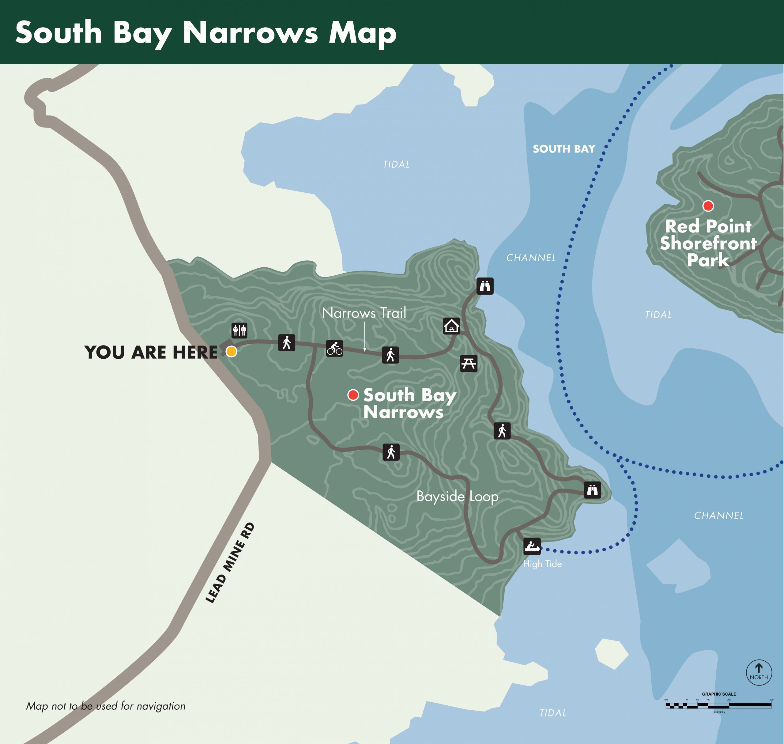
South Bay Narrows
Shoreline Trail and Paddle
AMENITIES
- Paddle Up Access
- Walking, Hiking and Biking Trails
- Shore Access
- Picnic Tables and Screened Picnic Pavilion
- Restroom

Parkland Information
Shorefront Access: 2,150 ft of Shorefront, with Paddle Up Access.
Walking and Biking Trails: Walk or bike the Narrows Trail; a grassy old gravel road from the parking lot to the shoreline, and The Narrows Picnic Pavilion (700 ft).
Hiking Trails: The South Bay Loop trail follows the shoreline from The Narrows Picnic Pavilion south to overlooks and water access. The trail then turns inland through a maple-spruce forest and old apple orchards meeting the Narrows Trail near the parking lot (0.4 miles).
Paddle Trails: Paddle up access from South Bay (Tide Chart) south of The Narrows Picnic Pavilion on the South Bay Loop trail.
Paddle at your own risk and stay aware of changing conditions.
Bike Routes: Bike the parklands of Denbow Neck, Morong Cove: Picnic and Paddle (4 miles), Island Coves: Picnic and Paddle –visits welcome by appointment- (5 miles), Huckins Beach and Trail: Paddle and Camping (5.9 miles) or the parklands of Crow’s Neck, Whiting Bay: Picnic and Paddle (4.3 miles), Race Point: Meadow and Reversing Falls Trail (6.7 miles) or Red Point Shorefront Park (3.5 miles).
Picnicking: The Narrows Picnic Pavilion is located at the end of the Narrows Trail and offers a long view east across South Bay with Red Point in the foreground and Scrub Island in the distance.