
ISLAND COVES
PICNIC AND PADDLE
Visitors Welcome By Appointment
AMENITIES
- Walking, Hiking and Biking Trails
- Shore Access
- Picnic Tables and Screened Picnic Pavilion
- Restroom

Parkland Information
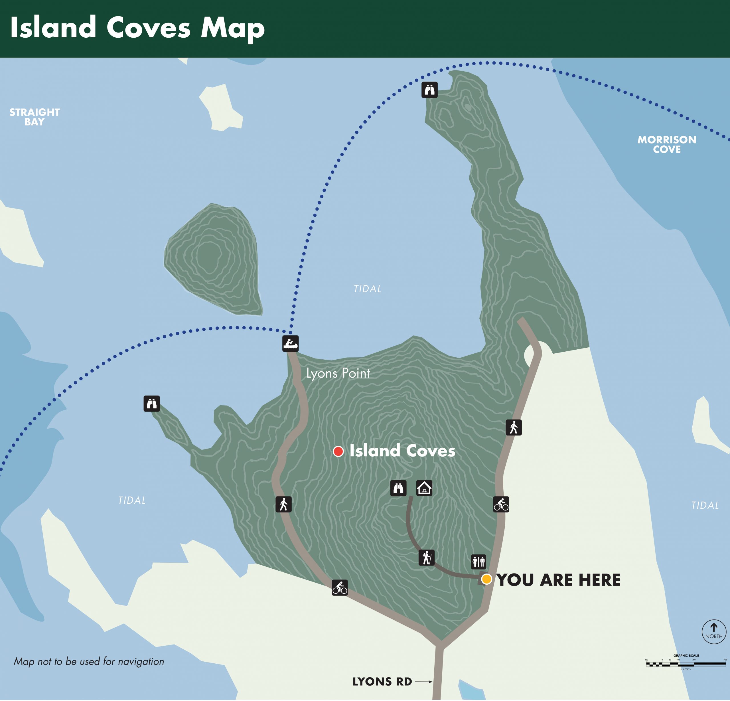
Shorefront Access: 4,000 ft of Shorefront, two rocky points and one island, mid-high tide Hand Boat Launch –
Visit by appointment: islandcoves@cobscookshores.org
Hiking Trails: From the parking lot, climb the hill to the Island Coves Picnic Pavilion (350 ft) for a bird’s eye view of Straight Bay and Denny’s Bay, or walk along the old gravel road to a mudflat crossing to the Island Coves island, accessible at low tide (1,200 ft). To the north of the parking lot, hike to the end of the old road and follow game trails to the end of the point. At the end of the point, you have a panoramic vista of the islands of Straight Bay.
Paddle Trails: Warning: the currents around Falls Island to the north of Island Coves are extremely fast moving and powerful. We suggest that only experienced salt-water paddlers or those with a Registered Guide use the Island Coves Hand Carry Launch. Paddlers should stay south in Nutter and Morrison Coves – high tide only. Click here for the tide chart.
Paddle at your own risk and stay aware of changing conditions.
Bike Routes: Bike the parklands of Denbow Neck, Morong Cove (1 mile south on Lyon’s Road), Huckins Beach and Trail: Paddle and Camping (3.8 miles north on Straight Bay Road) and South Bay Narrows: Shoreline Trail and Picnic (5.1 miles south on Straight Bay Road and East on Leadmine Road).
Picnicking: The Island Coves Picnic Pavilion is at the top of the hill 350 ft from the parking lot and offers a unique view of Race Point and Fall’s Island with Denny’s Bay in the background.